

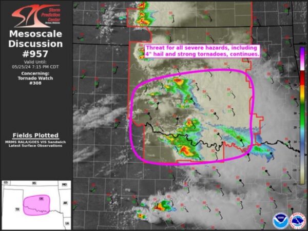
The severe weather threat for Tornado Watch 308 continues.
SUMMARY…All severe hazards, including very large hail up to 4″ and
strong tornadoes, remain possible into central/south-central OK and
north-central TX.
DISCUSSION…Regional radar imagery has shown a messy convective
evolution across northwest TX and southwest OK over the past two
hours, with the initially close-proximity initiation and numerous
left-splits contributing to numerous interactions. Some trend back
to a more discrete mode may be evolving, with 2 right-moving
supercells now apparent over Cotton County OK, and Archer and Clay
Counties in northwest TX. The southernmost supercell appears to be
the strongest currently, with strong low-level rotation and 60 kft
echo tops both noted in recent radar imagery.
Despite some boundary-layer cooling due to anvil shading, the
airmass ahead of these cells is still extremely buoyant.
Mesoanalysis estimates a large area of 3500-4000 J/kg of MLCAPE
remains from northwest TX/southwest OK into central/south-central OK
and north-central TX. Strong vertical shear exists as well, with
over 60 kt of 0-6 km bulk shear sampled with the VAD profiles at
both KFDR and KTLX. Some modest convective inhibition is likely in
place downstream, particularly given the now cooler surface
temperatures. However, the organized character to the ongoing storms
coupled with increasing large-scale ascent, should help these storms
persist in spite of this inhibition. The overall environment remains
supportive of very large hail up to 4″ in diameter, strong damaging
gusts, and tornadoes.
Some additional development is possible in the wake of this main
cluster across southwest OK where the airmass remains unstable.
There may be some influence from storm outflow, but the large-scale
ascent is just now beginning to arrive in this area, with additional
convective initiation still possible.
..Mosier.. 05/25/2024
Comments are closed.