
Amid cold front, South Texas faces rising flood threat this week
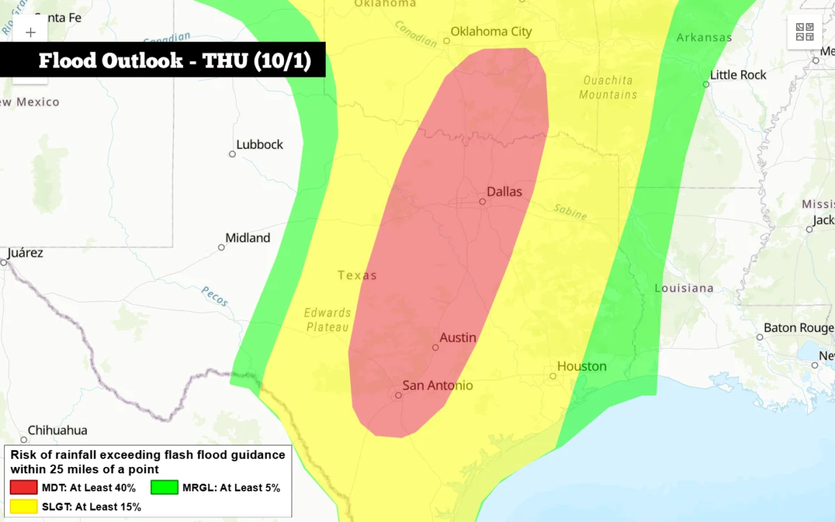
The last remnants of an unusually warm September will linger in South Texas this week before October kicks off a stretch of rainy, unsettled weather for San Antonio.
Official response and confirmed impact
The dramatic weather pattern shift will come courtesy of the first significant cold front of the fall, combined with high levels of Pacific moisture.
On Monday, San Antonio is shaping up to be mostly cloudy before gradually becoming sunnier by the afternoon.
Temperatures are expected to top out around 95 degrees. Humidity will continue to drive up heat index values, making those mid-90s feel more like 100.
East-southeast winds of 5 to 10 mph in the afternoon will turn into more blustery southeast winds of 10 to 15 mph with gusts as strong as 20 mph.
The influx of moisture-rich air into South Texas will increase clouds at night and keep temperatures above 75 degrees overnight into Tuesday morning.
However, the latest forecast data shows that the front may slightly delayed.
Incident background
Tuesday’s forecast Previous forecasts predicted that the cold front was expected to arrive late Tuesday and into early Tuesday.
